
")
")
World Tour 2016
First of all the global map as overview:
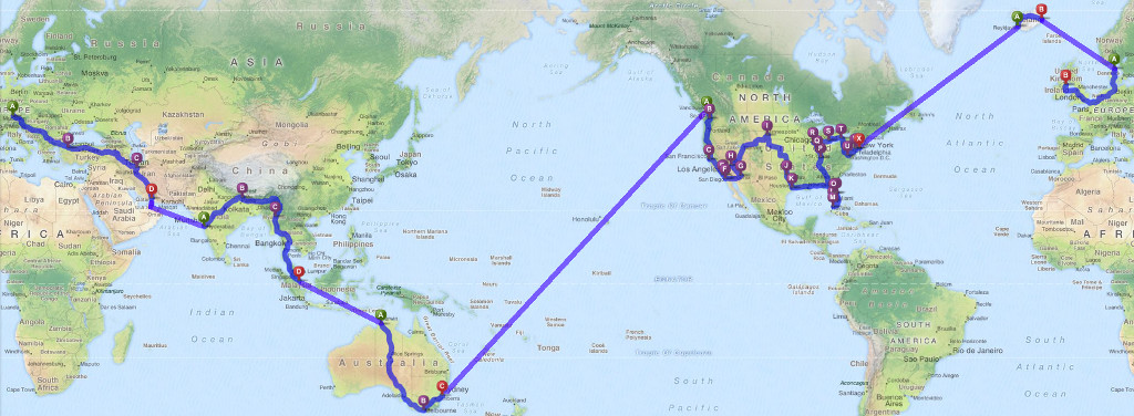
Data, imagery and map information provided by MapQuest, OpenStreetMap and contributors, CC-BY-SA
Through the Balkans to Arabia
The first part of the tour goes through the Balkans and Asia Minor to the Near East. The ferry brings the team from Iran to the Arabian Peninsula. The cars will be shipped from Sharjah/Dubai to India.
Years ago we planned to go from Iran to India via Pakistan but because this region is a bit instable currently the team decided against the direct way. Another alternative was the route through the past Soviet Republics using the Silk Road towards China. The meanwhile obsolete time line either required passing Tianshan Mountains with its passes Torugart (3,752m) or Irkeschtam (2,940m) or - in case of heavy snow fall - even an even more northern transit via Almaty. To avoid an extensive amount of winter equipment the trip was finally split into two parts starting the first part much earlier the year. This offered the chance to visit and pass the Himalaya.
Also the North African countries Tunisia, Libya and Egypt had to be removed from the itenary list as a tribute to the current policical situation in this part of the world.
Distance: ca. 6,000km
-
 Austria
 -
 Slovenia
 -
 Croatia
 -
 Serbia
 -
 Bulgaria
 -
 Turkey
 -
 Iran
Iran -
 United Arab Emirates
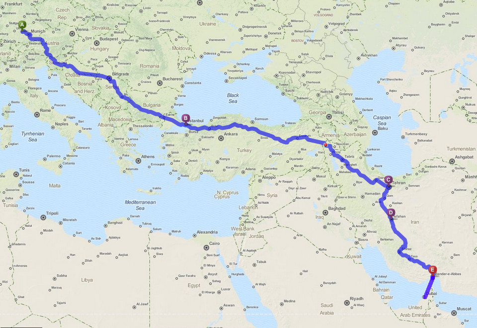
Data, imagery and map information provided by MapQuest, OpenStreetMap and contributors, CC-BY-SA
From India to Singapore
After nearly 2 weeks at sea and the arrival of the the cars in the port of Mumbai the adventure will go on while travelling through India. Through Nepal and its capital Kathmandu the team will ride the Friendship Highway to reach China and Lhasa, the capital of the province Tibet. Via Laos, Thailand and Malaysia we'll reach Singapore where the cars will again be shipped, this time towards Australia. The destination is most probably Darwin but at the end this depends on the availability of freight connections.
Distance: ca. 9,500km
-
 India
India -
 Nepal
Nepal -
 China
China -
 Laos
Laos -
 Thailand
 -
 Malaysia
 -
 Singapore
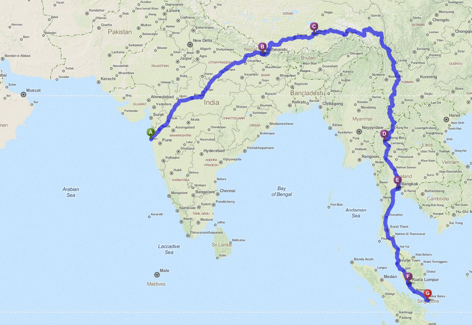
Data, imagery and map information provided by MapQuest, OpenStreetMap and contributors, CC-BY-SA
Australia
The routing through Australia is at the moment completely open and depends on the port of immigration. The preference is a tour from Darwin via Ayers Rock and Adelaide to Melbourne or Sydney. At the port of emigration the cars will be shipped again, this time to our preferred destination Vancouver.
The transfer will last about four weeks. As you remember the tour was split and started earlier as planned at the beginning. In order not to expand the originally planned time frame and because the transfer of the cars will anyway take quite a lot of time it's now time for a break of about 7 - 8 weeks. Christmas at home...
Distance: ca. 4,500km
-
 Australia
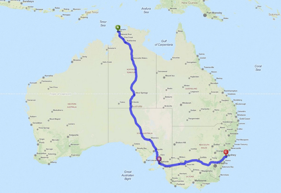
Data, imagery and map information provided by MapQuest, OpenStreetMap and contributors, CC-BY-SA
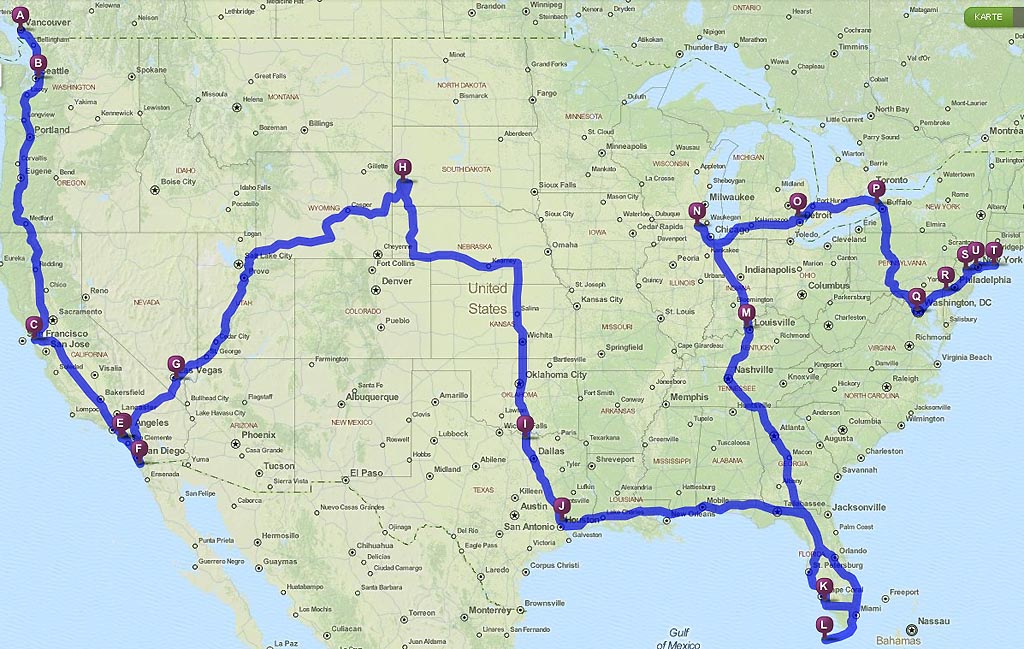
North America
After arrival of the Deloreans in Vancouver the trip will continue on the Highway No. 1 to South of USA. After a short visit to Mexico the team will go East to ride the legendary Road 66 to Chicago. If possible the cars will then be shipped from a port on the East Coast towards Iceland. If there is no such connection within the available time frame the cars will be directly shipped to Ireland, Great Britain or even to the European mainland.
Distance: ca. 15,000 km
-
 Canada
 -
 USA
USA -
 Mexico
Data, imagery and map information provided by MapQuest, OpenStreetMap and contributors, CC-BY-SA
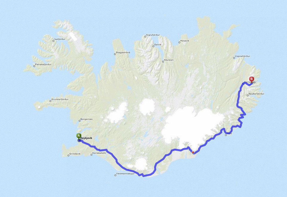
Iceland
Starting from the port in Reykjavik the next destination is the ferry port located in the East of the island.
Distance: ca. 700km
-
 Iceland
Data, imagery and map information provided by MapQuest, OpenStreetMap and contributors, CC-BY-SA
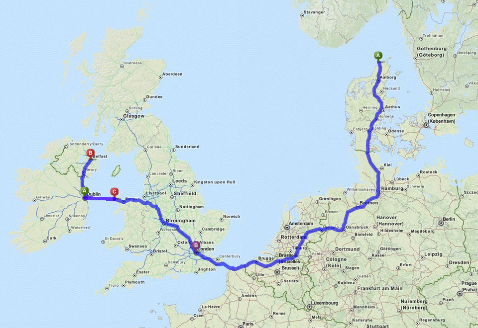
Let's go Ireland
The ferry passes the Faroe Islands to land in Danmark where the team starts to the last part of the trip to finally arrive to EUROFEST 2016 celebrating the Delorean cars born 35 years ago in Belfast. DONE!
Distance: ca. 2,200km
-
 Denmark
 -
 Netherlands
 -
 Belgium
 -
 France
 -
 Great Britain
 -
 Ireland
Data, imagery and map information provided by MapQuest, OpenStreetMap and contributors, CC-BY-SA